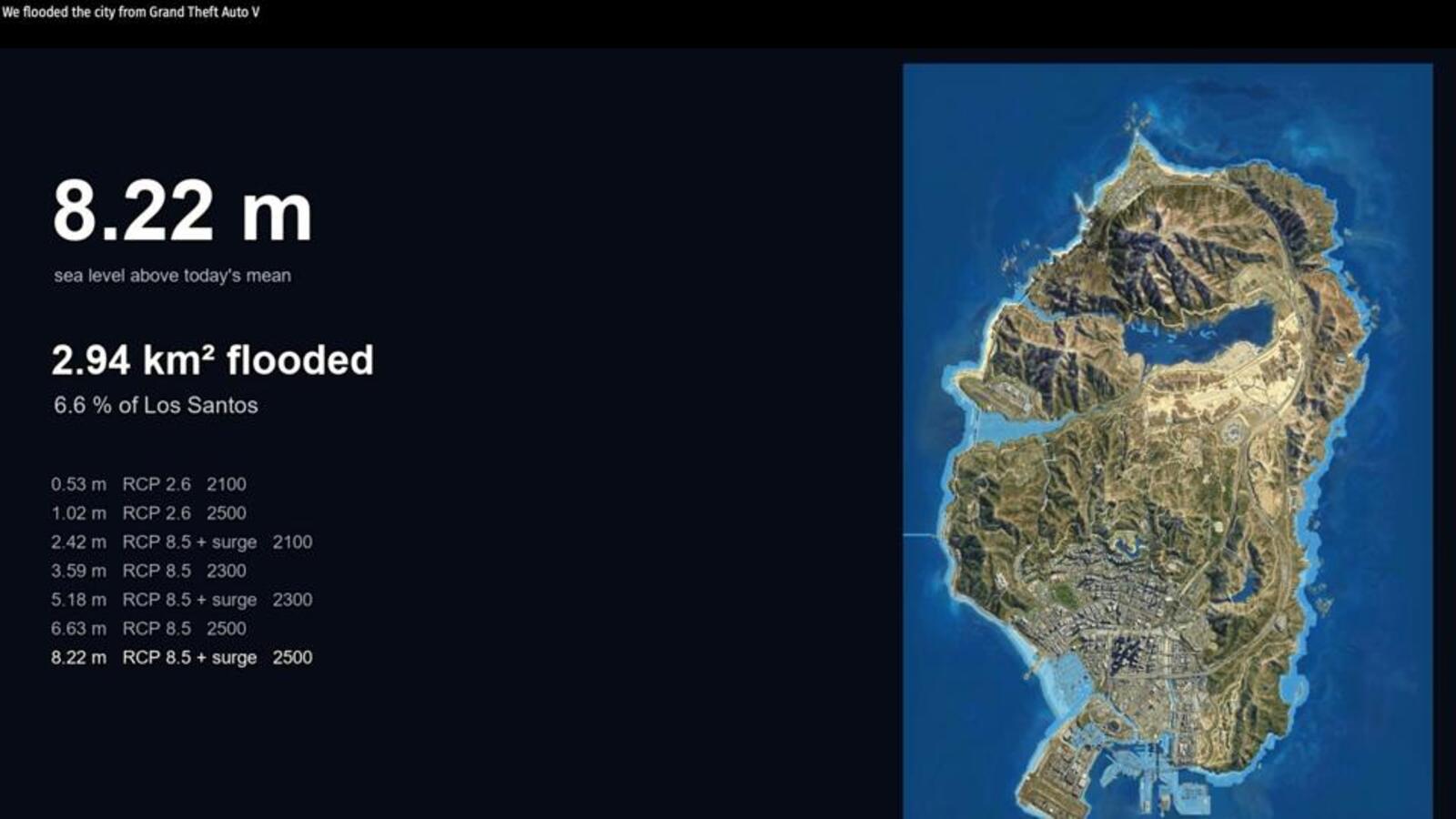
Scientists have used the fictional city of Los Santos from the video game Grand Theft Auto V to simulate the effects of rising sea levels, according to a study by Paul Nörenberg and Hugues Lantuit of the University of Potsdam and the Alfred Wegener Institute. The paper coincides with the launch of GTA VI. The researchers say Los Santos serves as an ideal case study because it closely replicates the real Los Angeles, allowing a direct comparison of simulated flood outcomes.
The scientists worked with two Representative Concentration Pathway scenarios from the Intergovernmental Panel on Climate Change (IPCC) Fifth Assessment Report. Under the RCP 8.5 scenario with storm surges, combined sea levels are projected to reach 5.18 m by 2300, with the model showing 5.1 per cent of the mapped land area inundated. For a 2500 scenario with projected sea levels of 8.22 mm, this increases to 6.5 per cent modelled inundation, placing the port, wastewater infrastructure and coastal energy facilities at risk. Under the RCP 2.6 mitigation scenario, the model shows 2.2 per cent of land area inundated at 2300 with storm surge, with no major infrastructure affected.
Rockstar does not release raw terrain data, so the scientists used a fan-built 3D model of the map, pinned it to coordinates with 11 control points and set the sea level from 31 shoreline points, checking it by flying an in-game helicopter along the coastline. The height was calibrated against the game's Mount Chiliad. They then simulated the IPCC scenarios for 2100, 2300 and 2500, each topped with a 1.59-metre storm surge, the highest Los Angeles has ever recorded. When overlaid on real maps and flood studies, the same districts stood most exposed: Vespucci floods like Venice Beach might, Chumash like Malibu, and the Port of South Los Santos is as vulnerable as the Port of LA.
Nörenberg, the lead author, says that if a familiar, personally explored virtual landscape changes, players can engage with the effects of climate change on an emotional level, bridging a gap that conventional visualisations struggle to achieve. The scientists recommend the approach as a template for geoscience communication using open-world video game environments, with the explicit caveat that the static inundation model and its limitations must be communicated transparently to every audience, and that the 2300 and 2500 horizons remain the weakest part of the scenario set.